


DJI DOCK 4
Always present, always ready
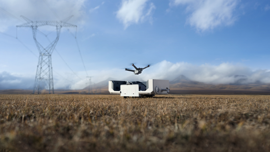
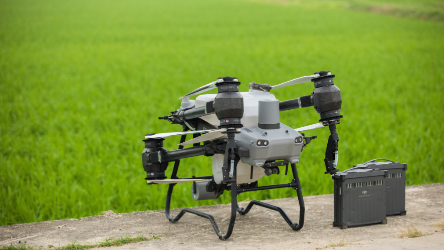
The DJI Dock 4 swaps batteries in 25 seconds for uninterrupted, urgent, or continuous automated operations. Your DJI Matrice 5TD features wide-angle and infrared cameras, mmWave radar, LiDAR, and artificial intelligence that detects 17 types of objects. The DJI O4 ground station enables access to complex sites, while the AI-powered workflow in DJI FlightHub 2 optimizes every operation.
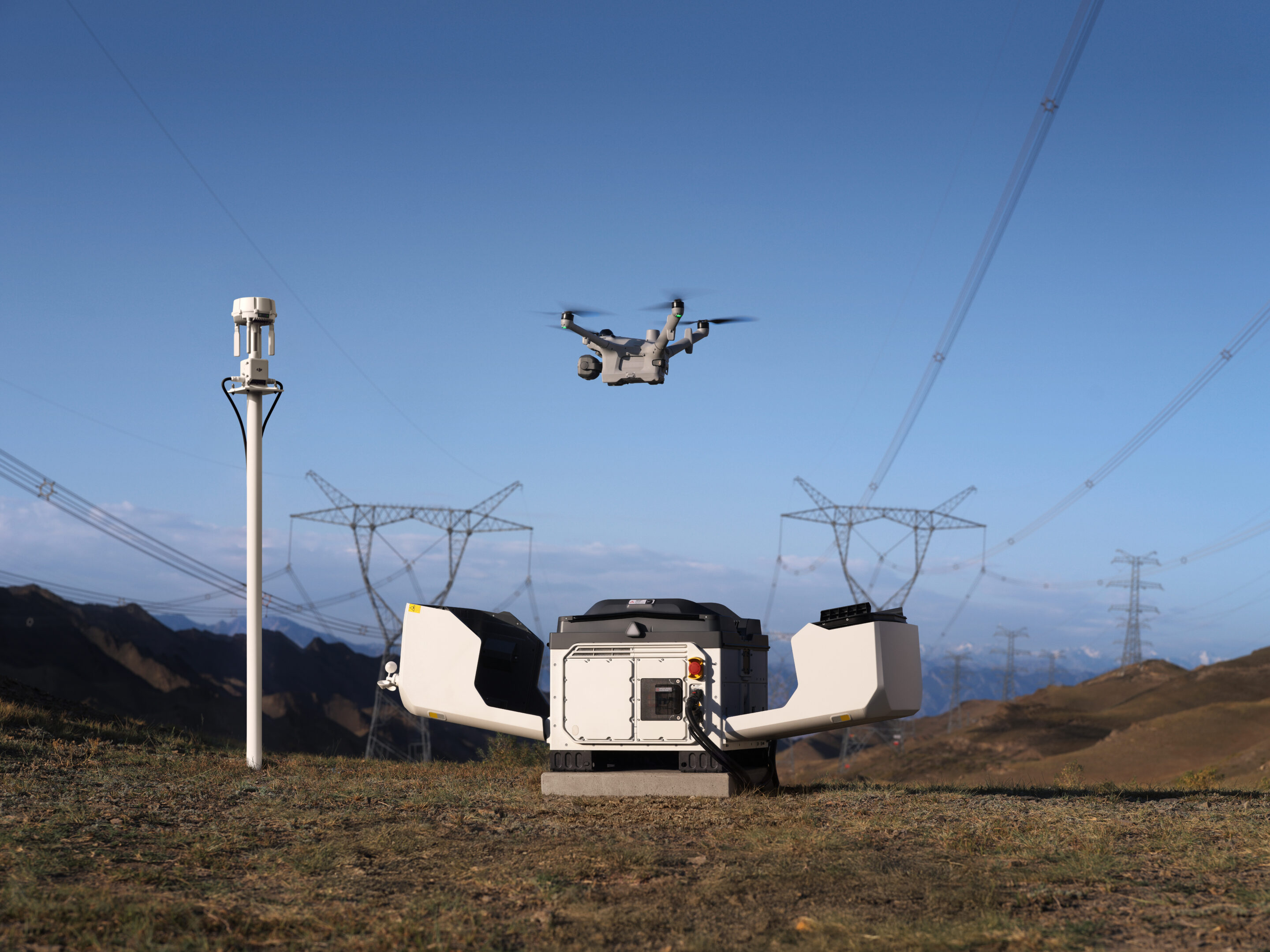
Ready in seconds for a quick response.
Built-in radars for reliable flight.
Multisensor integration for greater versatility.
Comprehensive solutions with integrated software.
AI-powered workflow for smart operations.
It complies with standards for safer operations.
Designed for a variety of sectors and industries.
In-flight on alert, ahead of ground teams
El dron se lanza tan pronto como se abre la cubierta, volando hacia el lugar a una velocidad de hasta 21 m/s para llegar antes que los equipos terrestres y transmitir instantáneamente el video en vivo.The drone launches as soon as the cover opens, flying to the site at speeds of up to 21 m/s to arrive ahead of ground crews and instantly transmit live video.
- Instant Launch: Once the order is given, the drone takes off instantly without the need for a pilot on site. Night and holiday emergencies receive a response in seconds.
- Rapid arrival at 21 m/s: At a maximum speed of 21 m/s, the drone flies directly to the site regardless of traffic conditions, saving critical time when it matters most.
Exchange, retransmit, maintain
For continuous tasks such as emergency response, the base completes a fully automatic battery change in just 25 seconds, reducing the response time between flights from a 30-minute recharge to just seconds.
Battery change in 25 seconds
Fully automatic battery change takes only 25 seconds. Previous flight data is automatically transferred during the change.
Long-term resistance
A single flight lasts up to 59 minutes, covering more ground in a single takeoff.
Wide operating temperature range
The charging station operates reliably between -40 °C and 50 °C (-40 °F and 122 °F), automatically preheats the batteries in cold weather, and uses air conditioning in high temperatures.
Task Relay
Any pair of aircraft in a project can automatically rotate between different locations, with one flying and the other on standby, to maintain uninterrupted situational awareness during emergency responses.
Live from the scene, remotely but accurately.
Thanks to low-latency live streams and high-speed data transfer, remote commanders can view the scene in real time and make decisions from outside the scene.

Multi-sensor integration for greater versatility.
Cerca y lejos, de día y de noche.
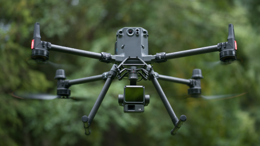
Matrice 5TD combines telephoto imaging, infrared imaging, laser measurement, and full-color night vision, while providing aerial inspection accuracy of up to 10 cm at 12 MP. Daytime inspections, nighttime security, and inspection are performed with a single drone, with no need to change the drone’s structure between scenarios, increasing equipment return on investment by 50%.
11x Telephoto
- Con una distancia focal equivalente de 252 mm, captura detalles de señales a 400 m de distancia y detecta defectos a nivel de pernos y pasadores a 100 m para la inspección de líneas eléctricas.With a 252mm equivalent focal length, it captures details of signs at 400m away and detects defects at the level of bolts and pins at 100m for power line inspection.
infrared camera
- The resolution reaches 1280 × 1024, or 2560 × 2048 in UHR mode, which allows for the detection of overheating and damaged insulators, with 2K recording and 32× zoom for nocturnal subjects.
Blending mode
- Las señales de luz visible e infrarroja se fusionan en una sola imagen, con modos de fusión de borde o superposición, lo que permite ver los contornos de la estructura y la distribución del calor sin necesidad de cambiar de señal.Visible and infrared light signals are merged into a single image, with edge or overlay fusion modes, allowing the outlines of the structure and heat distribution to be seen without having to switch signals.
Sharper nighttime performance
- 4K full-color night vision with high frame rate captures color images at night without needing to turn on the spotlight. The camera also combines with NIR auxiliary light for black and white night vision.
3 km laser measurement
- Superpone datos de alcance y coordenadas PinPoint en la señal para inspecciones de líneas eléctricas, operaciones de rescate o estimaciones de incendios forestales.Superimpose ranging data and PinPoint coordinates on signal for power line inspections, rescue operations, or wildfire estimations.
More payloads, more flexibility.
The Matrice 5TD can carry up to a 450g payload, with PSDK side mounts and a top mount that can be used simultaneously. Combine accessories according to the task.

Maximum payload of 450g
With three mounting positions and an effective payload capacity of up to 450 g, the drone can provide lighting, live streaming, and ground security all in a single flight.
Speaker/Spotlight / Parachute Combination
Install a loudspeaker, a spotlight, and a parachute together to provide aerial voice guidance and layered lighting during nighttime search operations, keeping ground crews safe.
Built-in customizable warning light
The built-in customizable warning light supports custom colors and flashing patterns, with no additional installation required.
Vuelo seguro, incluso en entornos complejos.Safe flight, even in complex environments.
With a three-directional mmWave radar, a rotating LiDAR, and a six-directional vision sensing system working together, the Matrice 5TD achieves precise obstacle detection, even within a substation full of operating equipment or around intersecting distribution lines.
Cable-level obstacle detection
Combining a rotating LiDAR, mmWave radar, and full-color low-light fisheye sensors, this system detects thin obstacles, including power lines, even at night.
Detección en seis direcciones a todo colorFull-color six-direction detection
Six-direction sensing works with six high-resolution, low-light fisheye sensors to maintain obstacle detection even under city lights at night.
Despliegue flexible para emplazamientos complejosFlexible deployment for complex sites
Powered by the Matrice 5TD’s LiDAR and visual SLAM, anti-interference and anti-spoofing algorithms, plus the DJI O4 ground station, DJI Dock 4 can be deployed next to skyscrapers or on a vehicle-mounted mobile platform (coming soon).

Near high-rise buildings
Installing the O4 ground station on rooftops improves signal quality, allowing Dock 4 to be deployed near tall buildings or along the walls of substations.
Roaming Between Multiple Stations
The O4 ground station
Safe, even when the unexpected happens
From detecting and alerting to multiple drones to emergency landings, the Matrice 5TD is ready for the unexpected. A parachute cushions the descent to protect people and equipment on the ground, multi-drone detection and alerts help maintain airspace safety, and the automatic Return-to-Home (RTH) system with descent in high winds allows the drone to return safely even in extreme weather conditions.
Parachute
Mounted on top of the Matrice 5TD, with an independent power supply, full link redundancy, automatic/manual deployment, and an FTS compatible with EU C5/C6 and UK5/UK6.
Detection and Alerts Using Multiple Drones
The Matrice 5TD’s built-in ADS-B and RID receiver helps alert you to nearby aircraft and RID-enabled DJI drones by overlaying flight paths on the map for a safer flight.
Descent in strong winds and return home
The Matrice 5TD takes off, lands, and operates in winds of up to 12 m/s. When winds pick up during the return flight, it descends and returns safely, even over mountains and forests

See more, understand more
The AI built into the Matrice 5TD now detects 17 types of objects in real time, while the virtual cockpit allows users to search for almost any type of object using text or an image.
- On-board detection: The Matrice 5TD performs real-time AI detection on live video streams, covering 17 types of objects, in addition to infrared hotspot detection and compatibility with third-party AI models.
- Generalized Intelligent Detection: In the virtual cockpit, object search works via text or image. The multimodal LLM interprets the prompts, detects objects, and triggers alerts to maintain situational awareness.
From alert to action—automatically
Once an anomaly is detected, the system can send alerts via SMS, email, or through the platform, and trigger actions such as screenshots, recording, tracking, or scanning, thereby completing the cycle from detection to response.
FlightHub 2 Co-Pilot
From drone control to flight commands, routes, and scheduled tasks, all you have to do is describe them in natural language. FlightHub 2 Copilot converts your intentions into commands for the drone.
Automated Workflows
Triggered workflows dispatch drones in response to third-party alerts, such as DFR calls. Scheduled workflows automatically handle data collection, modeling, analysis, and reporting.
Post-processing with AI: Reports in Minutes
After each operation, the system uses artificial intelligence to compare the most recent data with historical aerial photographs or 3D models, automatically records the results, and exports a report.
Intelligent Post-Processing Detection
Compare historical aerial photographs to automatically detect damage to facilities, changes in the terrain, and new, unauthorized structures.
Change Detection Pro
The AI compares historical aerial photographs, highlights areas that have changed, and generates a change report, condensing hours of work into minutes and eliminating the need for frame-by-frame review.
DJI FlightHub 2, the all-in-one cloud platform
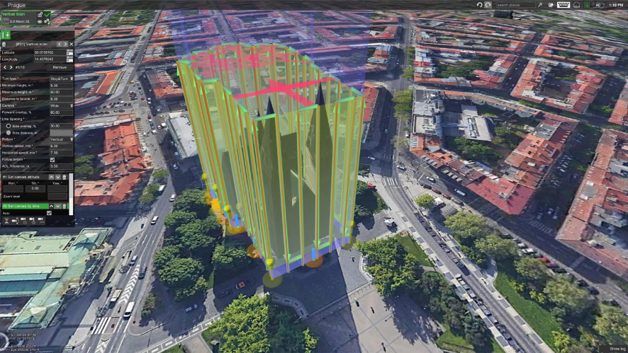
DJI FlightHub 2 combines rapid deployment, low-latency remote control, automated route planning, real-time cloud detection, AI-powered multimodal detection, post-processing, anomaly alerts, and OTA maintenance into a single platform that covers all stages of operations—from deployment and operations to air-ground coordination and long-term maintenance.
- Cockpit, Routes, and Control Panel;
- Multiple deployment options (public cloud/on-premises/all-in-one);
- Synchronization of OpenAPI and FlightHub.
DJI Enterprise App: Control in Your Pocket
The DJI Enterprise app manages on-site configuration and also serves as a remote operations center. In addition to configuring and troubleshooting the docking station, it allows you to trigger tasks and view them remotely.
Safe and Compliant for Safer Operations
Onshore Risk Mitigation
With a DJI-designed parachute, custom flight zones, and flight control with compliance by design, the DJI Dock 4 helps reduce flight risks and supports compliant operations in urban and complex environments.
- DJI Parachute System: A DJI parachute reduces the impact in the event of a sudden system failure.
- Custom Flight Zones: Custom flight zones, controlled directly by the flight controller, keep the drone within its preset area, reducing the risk of it flying outside authorized limits.
Airspace Risk Mitigation
Remote ID detection, AirSense, and third-party airspace data provide operators with real-time situational awareness, helping them assess risk before each mission and make informed decisions during flight.
Airspace Detection Using the O4 Ground Station
The DJI O4 ground station can connect to a third-party remote identification receiver via MQTT to detect nearby drones or manned aircraft in real time, thereby protecting the airspace.
Airspace Surveillance Using Drones
Matrice 5TD receives ADS-B signals from nearby aircraft and detects nearby drones, displaying their status in FlightHub 2 to help operators identify risks.
Airspace Surveillance by Third Parties
When connecting to third-party airspace information services, the platform displays conditions, restrictions, and risk warnings near the work area, which helps users make decisions before the mission and during flight.
Data Protection
Data Collection Phase
Drone operations generate commercial, flight, and device data. Once generated, this data is immediately transmitted over an encrypted channel to prevent interception, hijacking, and man-in-the-middle attacks. This protects your data from the very first second.
Data Transmission Phase
DJI employs strict encryption on all transmission nodes. Transmission from the drone to the base station uses TLS 1.2+ and AES-256 encryption. Uploads from the base station to the cloud use the HTTPS, WSS, and TLS protocols. These measures prevent data from being intercepted or tampered with during transmission.
Data Storage Phase
For stored data, DJI provides AES-256-CBC encryption for confidential information such as emails, phone numbers, and locations. In addition to encryption, strict access controls ensure that only authorized users can access the data. Furthermore, all access activity is logged, providing a comprehensive audit trail.
Data Deletion Phase
DJI allows you to delete data at three levels: account, organization, and device. When you delete an account, only that user’s data is erased. When you delete an organization, all associated data is erased. At the device level, you can clear local logs and the cache using the DJI Pilot app, or you can perform a full factory reset to erase all data from the device. In any case, the data can be effectively wiped.
An open ecosystem, breaking down barriers
- Open Intelligent Computing Platform
- Third-Party Payloads
- TerraGS-CesiumJS Web Plugin
- Coordinated Cloud-to-Cloud Operation
An update to the AI Inside feature introduces a completely new model architecture that supports dual-stream encoding, along with model quantification tools and deployment channels for embedded algorithms, helping to unlock new smart applications for drones.
The aircraft is equipped with three E-Port interfaces and supports a payload of up to 450 g, capable of carrying gas detectors, current flow meters, and other devices, which allows for a wider range of applications.
Built on the CesiumJS engine, this plugin enables third-party software platforms to load, interact with, and visualize high-precision, large-scale 3DGS data in real time. It is widely used in urban-scale 3D reconstructions, mixed reality, and digital twin applications.
Thanks to DJI FlightHub 2’s open API, users can quickly connect FlightHub 2 to a third-party cloud platform, making it easier to manage operational data.