



In today’s global landscape, monitoring climate change is more crucial than ever. Glaciers and icebergs provide vital information about environmental health. Recently, a groundbreaking scientific expedition to Greenland demonstrated how drone technology—specifically the DJI Mavic 3 Enterprise—is revolutionizing the study of these natural phenomena by providing high-precision data that was previously unattainable.
In this article, HPDRONES explores the details of this mission as an inspiring example of how these technological innovations are driving both cutting-edge scientific research and the most demanding industrial applications.
The Mission Aboard the Perseverance
In July 2025, the world’s largest oceanographic research sailboat, the Perseverance, served as the base for an expedition led by the iconic French explorer Jean-Louis Étienne. The mission was not only a test of human endurance but also an advanced technological platform. On board, experts such as Matthieu Lys (Airbus Defence and Space) and Nicolas Samsoen (a specialist in drones and photogrammetry) worked to merge two worlds: the macroscopic view of satellites and the microscopic view of drones.
This multi-scale approach is the new gold standard in climate research. While satellites offer a continuous, global view, drones allow us to “dive” into specific areas with a resolution that orbital sensors cannot yet match.
Case Study: Eqip Sermia and Sermeq Kujalleq
The expedition focused on two of Greenland’s most dynamic glaciers, using the DJI Mavic 3 Enterprise to conduct surveys that would have been impossible by other means:
- Eqip Sermia Glacier: The Accuracy of Photogrammetry
At this location, the team mapped an area of approximately 10 km². Using the DJI Mavic 3 Enterprise and a total of 12 batteries, it was possible to generate a high-resolution 3D model of the entire area. Even at flight altitudes exceeding 300 meters, the resulting photogrammetric models revealed morphological details crucial for understanding how the glacier is retreating and fragmenting.
- Sermeq Kujalleq (Jakobshavn): The World’s Fastest Glacier
Known as the fastest-moving glacier on the planet, Sermeq Kujalleq presents unique challenges. The mission focused on the mouth of the fjord, where multiple 3D models of newly calved icebergs were generated. These models allow scientists to analyze the calving process and the dynamics of the glacier front—essential data for predicting global sea-level rise.
The Methodology: The M3E’s Technological Leap
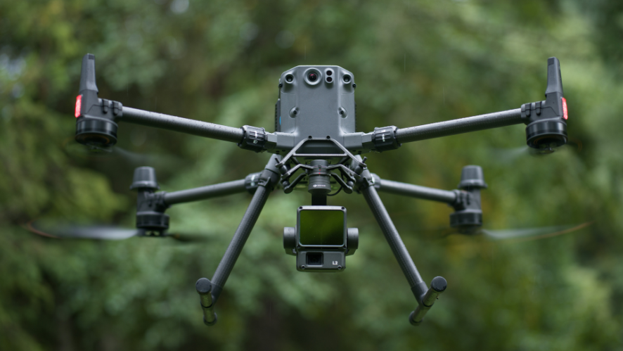
The use of the DJI Mavic 3 Enterprise on this expedition marks a paradigm shift. Traditionally, glacier mapping required helicopters or manned aircraft—options that are extremely costly and have a high carbon footprint. The M3E offers:
- Portability and Agility: The ability to operate from a sailboat in Arctic conditions.
- Centimeter-Level Accuracy: Through high-resolution sensors and RTK capabilities, essential for scientifically valid 3D models.
- Operational Efficiency: The ability to cover vast areas of ice in rapid missions, taking advantage of windows of favorable weather.
Collaborative Science and Democratization
One of the most innovative aspects of this mission was the partnership with the University of Aberdeen, led by glaciologist William Harcourt. The data collected by the drones is not confined to closed reports; instead, it is directly integrated into research models and used in university teaching.
This project demonstrates that drone technology is democratizing science. What once required massive institutional resources can now be accomplished by smaller, more agile teams using high-end commercial equipment. This agility is crucial at a time when the Arctic is changing faster than our ability to document it through traditional methods.
Conclusion
The successful integration of the DJI Mavic 3 Enterprise into the Greenland expedition marks a new chapter in climate monitoring. By providing high-resolution data that complements satellite observation, drones have become indispensable tools for scientists trying to decipher the future of our planet. At HPDRONES, we closely follow these advancements, recognizing that the technology we provide to the professional and industrial markets is the same technology that is, today, at the forefront of conservation and global scientific knowledge.
Learn more: https://youtu.be/7NRJIw3da5I?si=0P8WWHIz-Apd3Q6D