

3D scanning is becoming an increasingly important tool in fields such as architecture, engineering, construction, surveying, asset management, and the creation of digital twins.
But different projects require different types of data.
While a spatial camera focuses on creating visually realistic and immersive 3D representations, a spatial scanner is better suited for projects where geometric accuracy and measurable data are of greater importance.
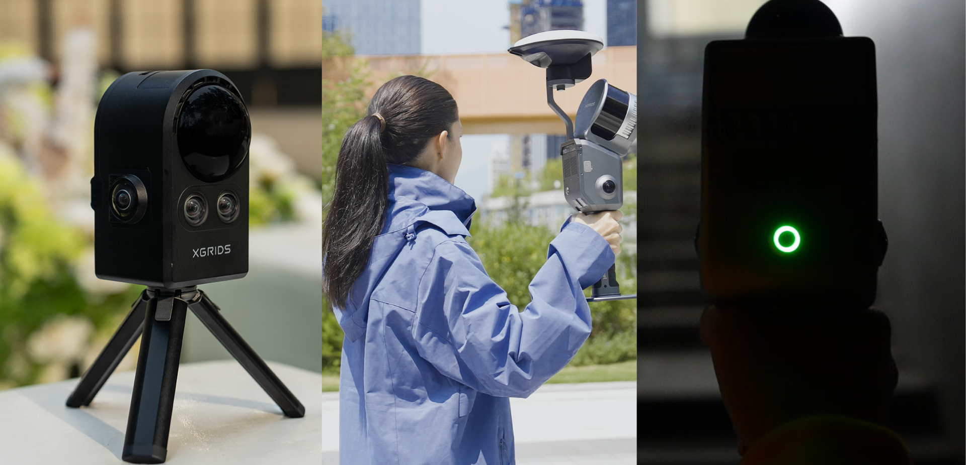
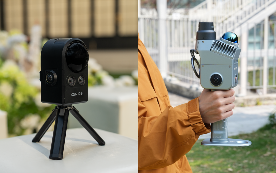
In the XGRIDS lineup, this difference can be illustrated by two devices: the PortalCam, a spatial camera, and the Lixel K2, a spatial scanner.
So, which one should you choose?
1. Start by asking: What result do you want to achieve?
Before comparing specifications, it’s important to understand the end use of the data.
Do you want to create a realistic digital representation of a space to view, present, share, or explore remotely?
Or do you need to collect high-precision spatial information to support measurements, surveys, engineering, or Scan-to-BIM processes?
This distinction is fundamental.
The choice, therefore, begins with the project’s objective—not just the equipment.
2. When does it make sense to choose a spatial camera?
When the visual component and the experience of exploring the space are priorities, a spatial camera may be the best option.
The PortalCam is designed to capture real environments and convert them into photorealistic 3D models. To do this, it integrates LiDAR and four cameras into a portable device weighing 870 g, allowing for the simultaneous collection of geometric and visual data.
The result goes beyond a sequence of photographs or a conventional virtual tour: it creates a three-dimensional environment that can be viewed and explored in an immersive way.
This approach can be particularly useful when you want to:
Visually document a property or space;
Create immersive 3D experiences;
Record the condition of a location;
Present spaces remotely;
Create content for architecture, real estate, or heritage;
Facilitate communication and collaboration around a real environment.
In this context, the priority is not merely to measure the space, but to realistically reproduce its appearance and context.
3. When should you choose a spatial scanner?
There are projects where visual quality alone is not sufficient.
When it is necessary to obtain precise spatial information, take measurements, or integrate the collected data into technical processes, a spatial scanner becomes particularly important.
The Lixel K2 uses LiDAR technology to perform mobile mapping and generate true-color point clouds, with a relative accuracy of 1 cm.
This capability makes it particularly well-suited for applications where three-dimensional spatial data serves as working data rather than merely a component of its visual representation.
It may make sense to use a spatial scanner in projects related to:
- Surveying and documenting spaces;
- Engineering and construction;
- Scan-to-BIM;
- Facade measurement;
- Construction site management and monitoring;
- Volume calculation;
- Infrastructure and industrial environments;
- Creation of digital twins.
In these cases, the 3D model serves as a source of measurable information to support technical processes and decision-making.
4. What kind of data do you need after collection?
Collecting data is only the first step. It is necessary to understand how this data will be processed and used by the teams.
With XGRIDS technology, PortalCam integrates into a workflow based on 3D Gaussian Splatting, designed to create photorealistic models. These environments can then be viewed, edited, and shared.
In the case of the Lixel K2, LiDAR data collection allows you to work with true-color point clouds, suitable for workflows where spatial information and geometry are critical.
Therefore, before purchasing the equipment, ask yourself:
- What file or model do I need to obtain?
- Do I need to take measurements?
- Will the data be used by architects or engineers?
- Do I primarily want to visualize and present the space?
- Is it necessary to integrate the results into other digital processes?
- Who will use the information after it is collected?
The final deliverable should help determine the technology used for data acquisition.
5. PortalCam or Lixel K2?
The decision can be simplified based on the project’s main priority.
Choose a spatial camera, such as the PortalCam, when:
- Visual realism is a priority;
- You intend to create immersive 3D environments;
- It is important to communicate or present the space;
- You are looking for a portable capture process geared toward creating photorealistic models;
- The model will be used primarily for visualization, documentation, or exploration of the environment.
Consider a spatial scanner, such as the Lixel K2, when:
- Geometric accuracy is critical;
- You need a point cloud;
- The data will be used for measurement or analysis;
- The project involves engineering, construction, or surveying;
- There is a Scan-to-BIM workflow or another technical use for the data.
Qual é a solução certa para o seu projeto?
Não existe uma resposta universal.
Mais do que comparar equipamentos apenas através das suas especificações, importa perceber qual deles responde melhor ao fluxo de trabalho e ao resultado esperado.
Na HPDRONES, ajudamos a avaliar os requisitos do projeto e a selecionar a tecnologia XGRIDS mais adequada à aplicação.
Está a avaliar a digitalização 3D de espaços ou infraestruturas? Fale com a nossa equipa e descubra qual a solução mais adequada ao seu projeto.