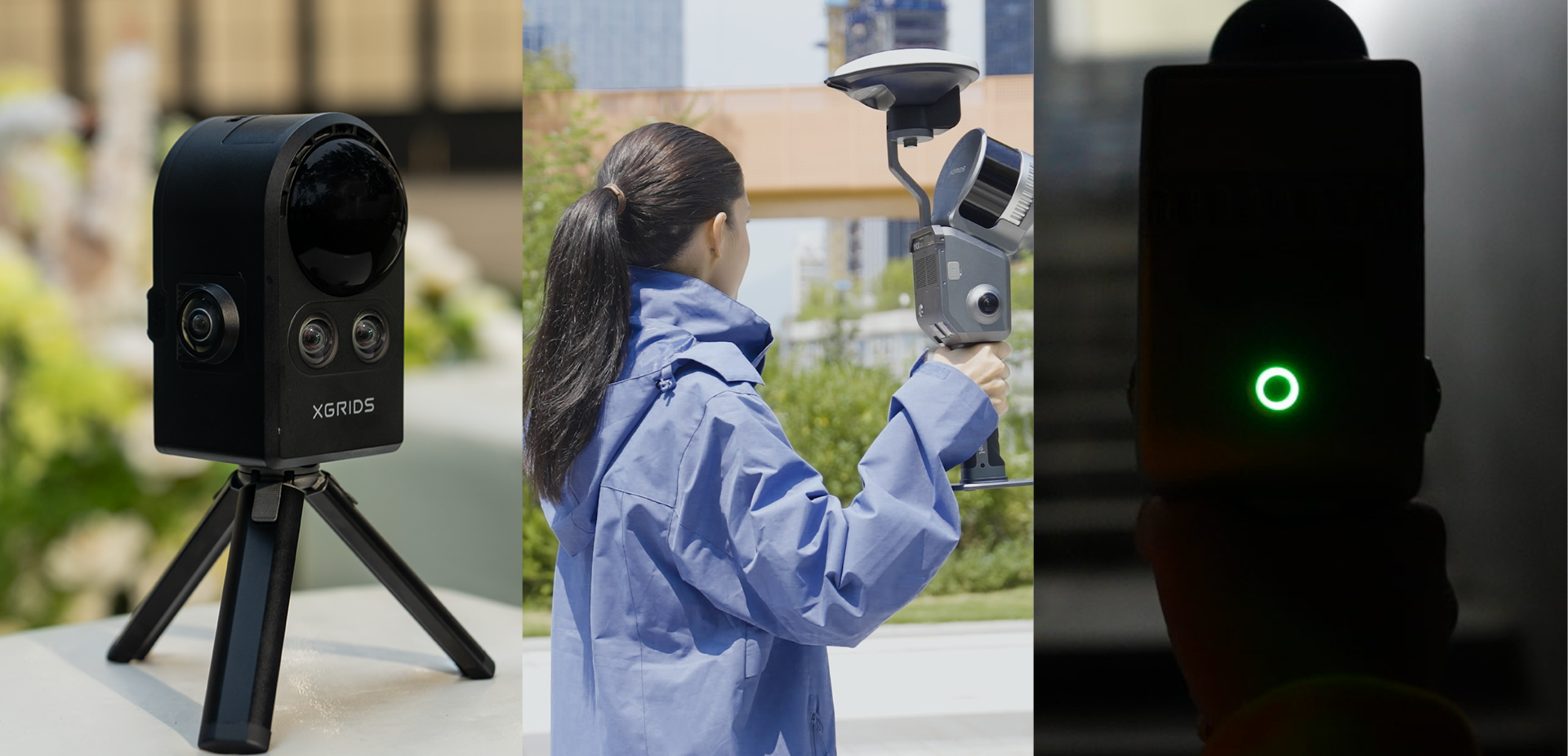



A LiDAR scanner designed to transform spatial data into usable results
In surveying, architecture, engineering, and construction projects, 3D data collection should no longer be evaluated solely by the amount of information captured. Geometric quality, point cloud consistency, and the ease of transforming the data into models, measurements, or visual presentations are equally important.
The Lixel L3 from XGRIDS meets these needs in a single portable device. The solution combines high-precision LiDAR, color panoramic cameras, integrated RTK, IMU, and SLAM processing into an acquisition workflow designed for complex environments and professional projects.
The result of a single capture can include a true-color point cloud, a textured 3D mesh, and a 3D Gaussian Splatting model. For businesses, this means that the same data can be used for different phases of a project, from measurement and modeling to visualization and client communication.
Precision in measurement, realism in communication
Precision is one of the core features of the Lixel L3. Under specific test conditions and with post-processing, the system delivers a verified relative precision of 5 mm and an absolute accuracy of 2 cm.
These values should be evaluated in light of the actual conditions of each survey, including the geometry of the space, the capture path, and the surrounding environment. Nevertheless, they demonstrate the L3’s suitability for projects where the point cloud needs to be more than just a visual representation: it must serve as the basis for measurements, technical documentation, and design decisions.
At the same time, the system features a camera with a 1/1.3” CMOS sensor and 4K HDR imaging, allowing for the preservation of color, contrast, and material detail. The combination of LiDAR geometry and visual information facilitates spatial interpretation and makes it easier to identify elements, surfaces, and assets during analysis.
A workflow with multiple outputs
One of the most notable features of Lixel L3 is the ability to generate different output formats from the same scan:
- True-color point cloud, for measurement, documentation, and analysis;
- Textured 3D mesh, for modeling and 3D applications;
- Gaussian Splatting 3D model, for immersive experiences, digital twins, visualization, and virtual production.
This approach can reduce the need to repeat the scan to obtain different products. The same database can power scan-to-BIM workflows, building surveys, as-built projects, renovation, asset inventory, facilities management, and space visualization.
Performance in Complex Environments
The Lixel L3 is designed for continuous data collection and for scenarios where positioning and reconstruction systems face greater challenges. The combination of LiDAR SLAM, RTK, and multimodal perception helps maintain model continuity in locations such as:
- Dense urban areas with obstructions or GNSS signal reflections;
- Tunnels and infrastructure corridors;
- Spaces with little visual texture;
- Repetitive structures;
- Bridges, riverbanks, and other waterfront locations.
The specified maximum range for the LiDAR is 120 meters, with a capacity of up to 640,000 points per second. The integrated RTK supports GPS, GLONASS, Galileo, and BeiDou, with a specified horizontal accuracy of 0.8 cm + 1 ppm and vertical accuracy of 1.5 cm + 1 ppm.
During data capture, the operator can monitor the point cloud on an integrated 4.3-inch screen with a maximum brightness of 1,000 nits. Real-time visualization helps verify coverage, identify potential gaps, and make decisions right on site.
Applications for surveying, AEC, and industrial companies
It can be applied to various types of professional projects, including:
Surveying and building surveys
Geometric accuracy and true color enable the creation of working bases for surveys, as-built documentation, facades, and analysis of existing structures.
Architecture, engineering, and construction
The data can support scan-to-BIM processes, renovation, building extensions, and validation of the as-built condition, bridging the gap between the physical space and the digital model.
Digital twins and asset management
The combination of point clouds, meshes, and 3D Gaussian Splatting creates a useful spatial foundation for facilities, campuses, equipment, and assets that need to be monitored or managed remotely.
Virtual production and 3D visualization
When visual realism is required, the 3D Gaussian Splatting model can be used for location scouting, previews, and virtual production, preserving the appearance and scale of the captured space.
A tool to bridge the gap between the field and the project
The value of the Lixel L3 lies in its combination of precision, visual information, and a variety of deliverables. Instead of choosing between a measurement-oriented solution and one designed for presentation, teams can work from the same scan to meet both technical and visual needs.
For companies seeking to make their survey workflows more comprehensive and efficient, the Lixel L3 stands out as a professional 3D mapping tool, well-suited for projects where data quality and reusability have a direct impact on the final result.
Contact us to learn how XGRIDS’ Lixel L3 can be applied to your projects.