

The use of LiDAR technology on drones has been transforming the way topographic surveys, mapping, and land analysis are conducted. However, given the wide variety of solutions available, a fundamental question arises: how do you choose the most suitable LiDAR sensor for each project?
The answer depends on several technical and operational factors. Choosing the right LiDAR system directly influences data quality, operational efficiency, and return on investment (ROI).
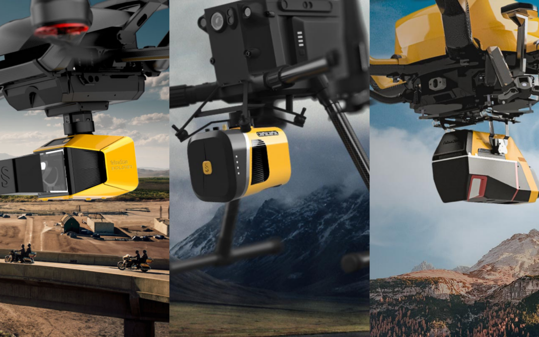
In this guide, we analyze three solutions from YellowScan and explain the appropriate context for each: Explorer, Mapper+, and Voyager.
Types of LiDAR Projects and Technical Requirements
Before selecting a LiDAR sensor, it is essential to understand the type of project to be carried out. Generally speaking, projects fall into three main categories:
- Projects that require high accuracy and detail
- Projects that require versatility and operational efficiency
- Large-scale projects focused on coverage and productivity
Each of these needs entails distinct requirements in terms of point density, range, acquisition speed, and processing capacity.
YellowScan Explorer
LiDAR sensor for maximum accuracy and detail
The YellowScan Explorer is a LiDAR sensor designed for applications where data accuracy and level of detail are critical.
This system stands out for its ability to generate high-density point clouds, enabling an accurate representation of the terrain and complex structures.
Main applications:
- High-precision topographic surveys
- Civil engineering projects
- Detailed terrain modeling
- Analysis of areas with dense vegetation
Technical advantages:
- High LiDAR point density
- Advanced multiple-return detection capability
- High accuracy in complex environments
When to use: The YellowScan Explorer should be selected when a project requires highly detailed and accurate LiDAR data, especially in technically demanding contexts.
YellowScan Mapper+
Versatile LiDAR sensor for multiple applications
The YellowScan Mapper+ is a well-balanced LiDAR solution, designed to meet a variety of operational needs with consistent performance.
This system is particularly well-suited for companies that conduct frequent and diverse surveys and require a reliable and efficient solution.
Main applications:
- Drone surveying and mapping
- Infrastructure surveys
- Land monitoring
- Recurring surveying projects
Technical advantages:
- Good balance between performance and cost
- High versatility of use
- Easy integration with different UAV platforms
When to use it: The YellowScan Mapper+ is the right choice when you need a flexible, efficient solution that can adapt to various types of projects.
YellowScan Voyager
LiDAR Sensor for Large Areas and Maximum Productivity
The YellowScan Voyager was developed for large-scale operations where terrain coverage and operational efficiency are priorities.
Its ability to operate at higher altitudes and cover extensive areas significantly reduces the number of flights required.
Main applications:
- Surveys of large areas
- Mapping of infrastructure corridors
- Large-scale environmental projects
- Land-use planning
Technical advantages:
- Extensive operational range
- High productivity per mission
- Efficiency in large-scale projects
When to use it: The YellowScan Voyager should be used when the goal is to maximize coverage and optimize LiDAR data acquisition time.
Simplified technical comparison
| Feature | Explorer | Mapper+ | Voyager |
| Accuracy | 2 cm | 4 cm | ~1 cm* |
| Reach | up to 500 m | up to 130 m | up to ~1000 m* |
| Pulses per second | up to 500 000 | up to 240 000 | up to ~2000 000* |
| Number of returns | up to 5 | up to 2 | up to ~32* |
| Weight | ~1.8 kg | ~1.3 kg | ~3.5 kg* |
*Typical values for the Voyager series (vary depending on configuration)
Choosing the right LiDAR sensor for drones is critical to the success of any survey or mapping project. The right selection allows you to optimize resources, improve data quality, and ensure greater operational efficiency.
HPDRONES offers LiDAR solutions tailored to different needs, ensuring specialized technical support at every stage of the project.
To identify the system best suited to your operation, contact us and discover how to get the most out of LiDAR technology.